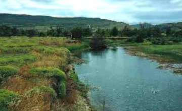
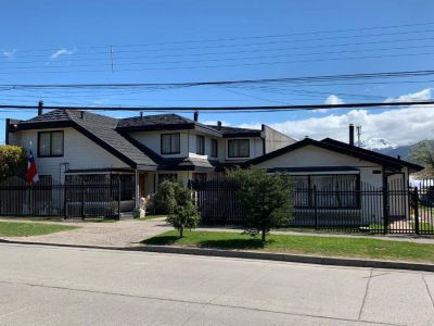
Touring around its streets, watching its architecture and discovering the natural beauties surrounding this district are excellent ways to learn about the idiosyncrasy of its dwellers who watch it grow every day. To make a conscientious tour, we made contact with Mario Jara Millar, owner of the travel agency named Turismo Rural Chile. He presented an amusing program to see the main sights in town. The tour began at the Plaza de Armas, opposite the Handicrafts Market. At that point, our guide engaged in the task of telling us about some relevant historical events occurred in Coyhaique. “Its first dwellers were Chileans who entered the area from the Argentinian pampas to devote their lives to cattle farming. The city was called three different names until it got its present name”, Mario explained and added: “First, it was known as Cancha de Corral, then as the District of Baquedano and, finally, and thanks to local customs, it began to be referred to as Coyhaique, which in the Mapuche tongue stands for ‘good place for camping’.”
Step by Step around the City
It seems that before the colonists reached these lands, the Mapuche community would use this site for camping on their way from the plains to the mountains and vice versa. The site features a very good layout in spite of being quite a recent settlement. The tour continues on board a 4WD vehicle, which promised to take us down to the most interesting corners in town. We stopped at Plaza del Pionero (Pioneer’s Square) in order to observe one Coyhaique icon: the Monument to the Shepherd. The wool industry is one of the economic engines in these latitudes. The city tour continued along the various alleys that led us right in front of the House of Culture and the first buildings in the estancia known as Sociedad Ganadera de Aysén. Back on the route and after crossing a suspended bridge over the Simpson River, we could see the profile of The Indian in the rocks. Nature and the winds have carved the monumental profile of an Indian on the rock. As time went by, it became one of the postcards of this district. It is important to notice that just one and a half kilometer away to the west of The Indian rock vantage point, there lies a fish farming station where salmon and sturgeon are bred. We highly recommend a visit. We resumed our march on a 4WD vehicle towards the ENTEL footbridge and headed for the satellite dishes area in order to obtain a panoramic sight of the entire city. From this viewpoint, we could appreciate the size of the urban area and the hills around it, as well as the facilities of one of the Rodeo Clubs. Mario told us that the Regional Rodeo Society prepares an active season program every year which starts with the Coyhaique Official Rodeo, on October 10 and 11, and ends with the Regional Championship on the 12, the date on which the foundation of the City of Coyhaique is commemorated. “Thus, other official rodeos are held at Balmaceda, Valle Simpson, Puerto Aysén, Mañihuales and in Coyhaique again at the OGANA Agriculture and Cattle Exhibition, to end at Chile Chico with the Great Huaso Festival, in February”, our guide said as he invited us to visit the city in that season. We promised we would. Finally, we returned to Coyhaique through El Claro area and stopped at the Monument to Mate on the way. In this region, just like in Argentina and Uruguay, people like drinking this beverage very much. We retraced our steps and the city tour came to an end at the very same point it had started: Plaza de Armas.
Marcelo Sola
Eduardo Epifanio
Contact of the excursion or tour
Turismo Rural Patagonia
Eusebio Lillo 135, Coyhaique, XI Región, Chile
Phone: +56 67-2253031


